


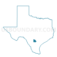
Voting District 0014, Atascosa County, Texas
About
Outline

Summary
| Unique Area Identifier | 670190 |
| Name | Voting District 0014 |
| County | Atascosa County |
| State | Texas |
| Area (square miles) | 43.00 |
| Land Area (square miles) | 42.96 |
| Water Area (square miles) | 0.04 |
| % of Land Area | 99.90 |
| % of Water Area | 0.10 |
| Latitude of the Internal Point | 28.83062380 |
| Longtitude of the Internal Point | -98.52433610 |
Maps


Graphs
Select a template below for downloading or customizing gragh for Voting District 0014, Atascosa County, Texas


Neighbors
Neighoring Voting District (by Name) Neighboring Voting District on the Map
- Voting District 0013, Atascosa County, TX
- Voting District 0018, Atascosa County, TX
- Voting District 0019, Atascosa County, TX
- Voting District 0021, Atascosa County, TX
Top 10 Neighboring County Subdivision (by Population) Neighboring County Subdivision on the Map
Top 10 Neighboring Place (by Population) Neighboring Place on the Map
Top 10 Neighboring Unified School District (by Population) Neighboring Unified School District on the Map
- Pleasanton Independent School District, TX (17,159)
- Jourdanton Independent School District, TX (6,218)